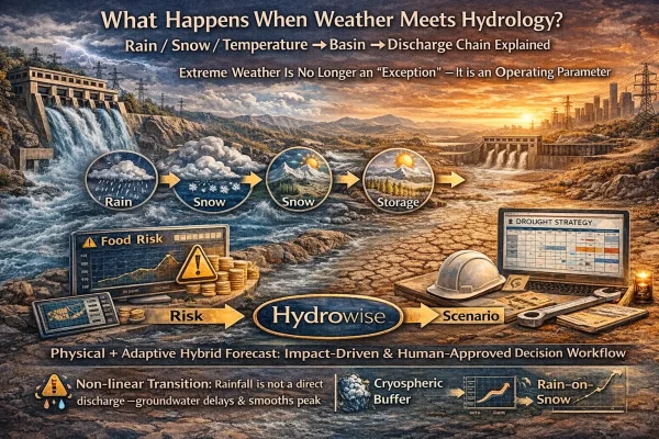
What Happens When Weather Meets Hydrology? Rain / Snow / Temperature → Basin → Discharge Chain Explained
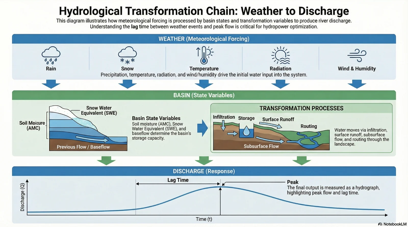
For hydropower operators, the most valuable question is simple to ask and difficult to answer: When will the water that falls from the sky become discharge—and how much power will it produce? In practice, the forcing (rain, temperature, radiation, wind, humidity) to response (discharge) link is non-linear and filtered by basin state variables such as soil moisture (AMC), snow water equivalent (SWE), storage, and channel routing—making both timing and magnitude uncertain. As stationarity weakens under climate change, forecast workflows that rely heavily on historical statistics become fragile, so the full forcing–state–response chain must be modeled and monitored.
- Non-linear transformation: Rainfall-to-discharge is not proportional; infiltration capacity and antecedent moisture (AMC) reshape outcomes.
- Cryospheric buffer: Snow stores water as SWE; SWE and melt rate dominate spring inflow timing and planning.
- Lag is operational: Peak timing errors (hours–days) create costly deviations in scheduling and market exposure.
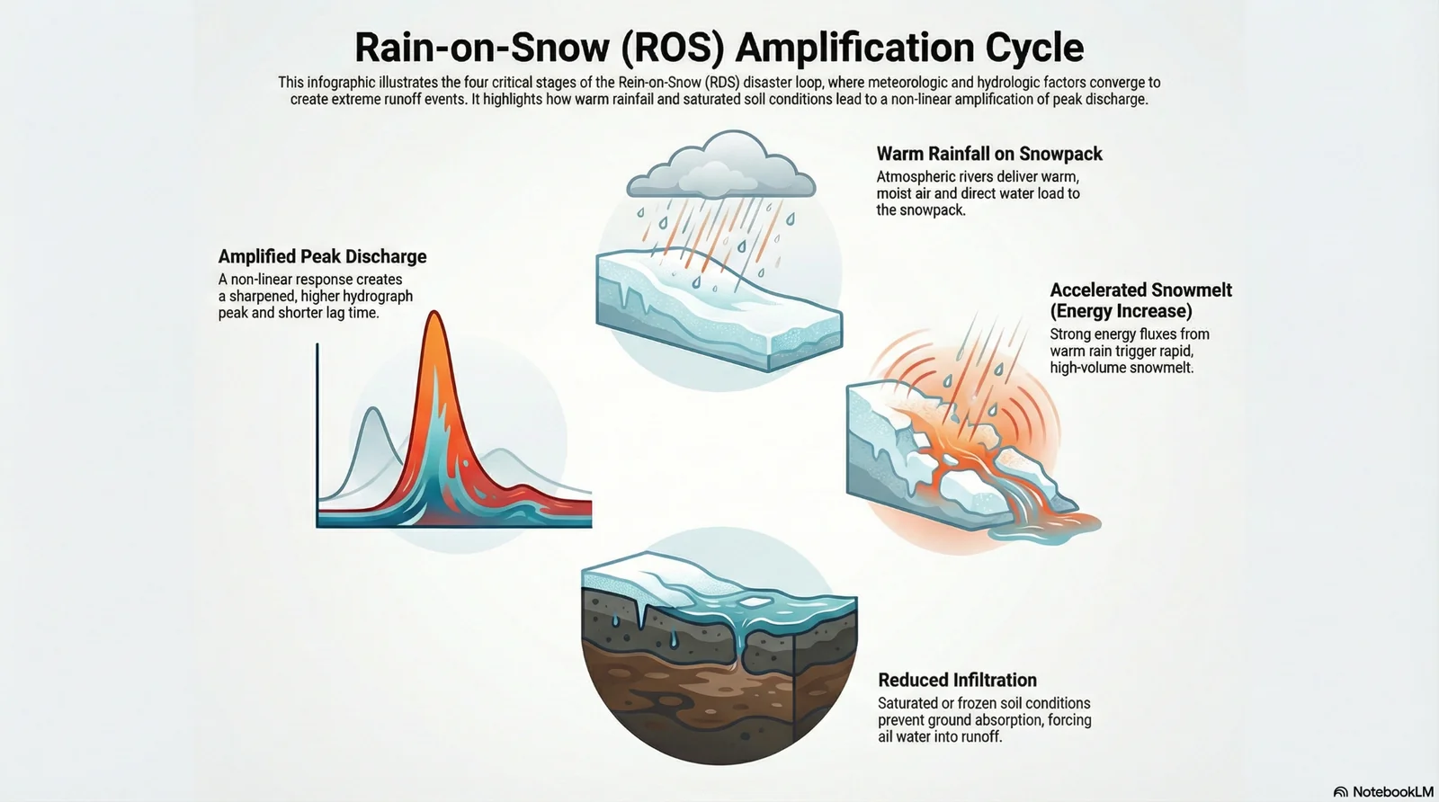
- Rain-on-Snow (ROS): Warm rain + snowpack energy can amplify peaks and shorten lag—hardest regime to forecast.
- Hybrid stability: Physics + adaptive ML correction improves robustness under regime shifts versus single-method approaches.
Concepts and Background: Forcing–State–Response
Modern hydrologic forecasting is best understood as a chain of forcing → state → response. “Forcing” is what the atmosphere delivers (rain/snow phase, temperature, radiation, wind, humidity). “State” is basin memory (AMC/soil moisture, SWE, storage, baseflow context). “Response” is discharge—shaped by infiltration, storage, subsurface pathways, and channel routing. Operationally, discharge is never a direct function of rainfall alone; it is the result of rainfall interacting with the basin’s current state.
Mass balance: Where does the water go?
- infiltration (soil/groundwater)
- surface runoff
- storage (snow, soil, reservoir)
- evapotranspiration
Energy balance: In what phase is water—and how fast does it move?
- snowmelt
- evaporation / condensation
- radiation-driven processes
How It Works: End-to-End Weather → Basin → Discharge Chain
In enterprise forecasting operations, the transformation can be framed as an end-to-end pipeline:
- Forcing: precipitation amount + intensity + phase (rain/snow), temperature thresholds, radiation, wind & humidity
- State: AMC/soil moisture, SWE/snow storage, baseflow/previous flow context
- Transformation: infiltration, storage, surface & subsurface flow partitioning
- Routing: channel translation influenced by roughness, cross-section, floodplain coupling
- Response: discharge hydrograph (peak magnitude + lag time)
Forcing: What variables actually drive discharge?
- rainfall amount + intensity + phase (rain/snow)
- temperature (0°C thresholds can be decisive)
- radiation (critical for snowmelt energy input)
- wind + relative humidity (energy balance components)
State: Why basin “memory” is mandatory
- AMC / soil moisture
- SWE / snow storage
- previous discharge / baseflow proxy
Operational Impact for Hydropower Plants: Why Timing and State Errors Become Expensive
For hydropower operators, discharge forecasting is not only an engineering task—it is a commercial risk function. Inaccurate timing (lag) and state estimation (AMC/SWE) translate into deviations in hourly schedules, reservoir decisions, spill risk, and exposure to imbalance mechanisms. In short: if the model is right about rainfall but wrong about basin state or routing, the plant may still be wrong about the hour that matters.
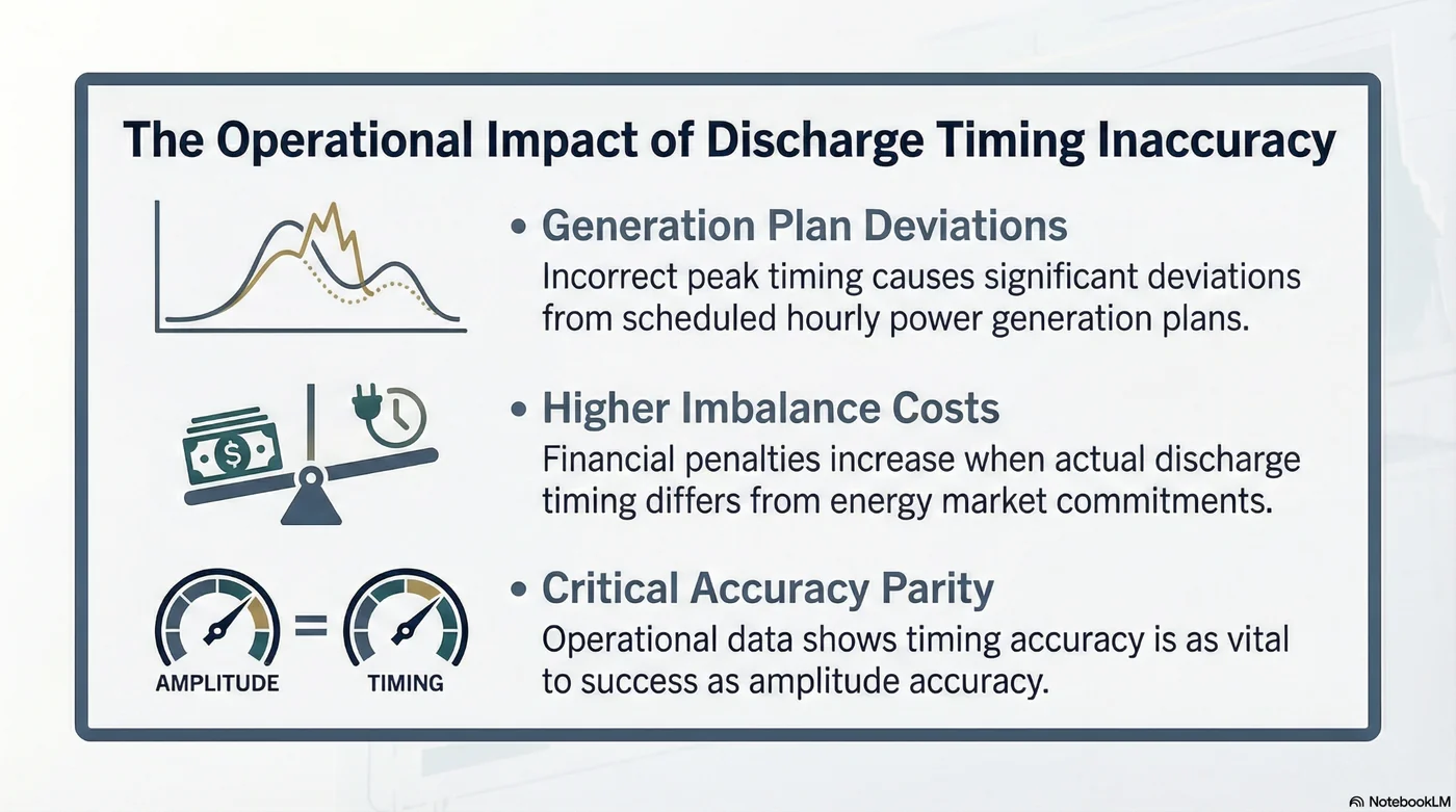
Where costs surface first
- Generation plan deviations: wrong peak timing distorts hourly production schedules.
- Higher imbalance costs: timing mismatch increases settlement deviation risk.
- Opportunity cost & spill: if inflow arrives earlier/later than expected, reservoir flexibility drops.
- Asset stress: high-flow regimes can elevate sediment and wear risks.
Scenario Snapshot: What Rain-on-Snow (ROS) Teaches Forecasting Teams
ROS events are compound regimes: warm rainfall adds direct water input while simultaneously increasing snowpack energy, accelerating melt. If soils are saturated or frozen, infiltration decreases and more water routes into runoff. The result is a non-linear amplification of peak discharge and often a shorter lag—exactly the regime where linear assumptions fail.
Key Physical Drivers That Reshape Discharge
Infiltration and Antecedent Moisture (AMC): the basin’s first filter
Whether rainfall becomes runoff or infiltration depends not only on soil properties, but also on antecedent moisture condition (AMC). When rainfall intensity exceeds infiltration capacity, Hortonian overland flow occurs. If AMC is high, infiltration drops and a larger share enters fast-flow components—raising peaks and increasing forecast sensitivity.
Operational takeaway
Low AMC can cause overestimation if teams scale production purely on forecast rainfall; high AMC can cause under-preparedness for peaks if infiltration is assumed too high.
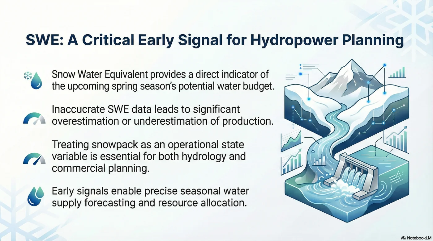
Snow Dynamics and SWE: natural storage and natural delay
In snow-dominated basins, snowpack acts as storage and delay. SWE indicates potential seasonal water budget and melt timing risk. Melt rate—driven by energy balance terms (not only temperature)—can shift peaks earlier and higher, impacting seasonal scheduling and reservoir decisions.
Channel roughness (Manning’s n) and routing: the channel changes too
Routing is not a minor detail. Variability in channel roughness and floodplain coupling can change wave speed and arrival time. Under high flows, timing error can expand materially—so “peak timing accuracy” should be treated as a first-class operational KPI, not a secondary metric.
Enterprise Modeling Strategy: Why Hybrid Architecture Improves Stability
In heterogeneous data conditions and changing regimes, no single method works everywhere. Hybrid architectures combine:
- Physics-based modeling: preserves process constraints and basin logic
- Adaptive correction: captures non-linear bias patterns and improves stability under drift
Hydrowise / Renewasoft Approach: From Forecasting to Decision Workflow
Hydrowise treats the weather–basin–discharge chain as an enterprise decision workflow rather than a standalone forecast curve. The objective is not only “better accuracy,” but more stable operational performance and earlier risk visibility under regime changes.
1) Weather ingest & phase separation
Rain vs snow separation and temperature thresholds are explicitly managed in the forcing layer, since phase errors propagate directly into SWE and runoff components.
2) State estimation: SWE / AMC proxies
State variables are made visible and trackable: SWE as seasonal storage and AMC as runoff readiness. This improves interpretability and reduces systematic bias during transitions.
3) Hybrid forecasting: physical model + adaptive correction
Physics outputs can be bias-corrected to improve stability under regime shifts, especially when extreme events break historical patterns.
4) Routing & timing governance
Because timing errors often drive costs, routing KPIs (lag profile, peak timing deviation) are monitored and escalated when risk increases.
FAQ
- Why isn’t rainfall directly proportional to discharge at the plant?
Because rainfall is filtered by infiltration and storage; AMC controls how much becomes runoff. - What is lag time?
The time shift between storm forcing and discharge peak; it depends on basin morphology and routing. - Why are ROS events so dangerous?
Warm rain combines with snow storage and energy forcing, producing non-linear peak amplification and timing shifts. - Why shouldn’t Manning’s n be treated as constant?
Roughness can vary with flow intensity and floodplain coupling, increasing timing and peak errors. - What does a hybrid model add?
It preserves physical structure while reducing systematic bias via adaptive correction—more stable under regime shifts. - Can we forecast snow basins without SWE?
Yes, but uncertainty increases and systematic spring bias risk rises. - Which operational KPIs should be tracked?
Track peak timing accuracy separately from magnitude metrics; timing often drives commercial deviations.
Conclusion and Next Steps
When weather meets hydrology, the system becomes non-linear: AMC, SWE, routing and compound regimes like ROS interact across space and time. Organizations that rely on static, history-heavy workflows will see more failures as regimes shift. A layered, hybrid approach that explicitly models forcing–state–response and monitors timing risk is becoming the operational standard.
- Define a minimal state set for your basin: AMC proxy + SWE proxy + lag profile
- Build early-warning triggers for compound event classes like ROS
- Track peak timing as a KPI—separately from magnitude
- Test a layered & hybrid approach with the Hydrowise Forecast module in a demo workflow
Call to action: To reduce uncertainty in production planning, manage imbalance risk, and build early-warning capability for extreme weather, contact the Hydrowise team and request a demo.